The first step is key.
Data is the foundation of every successful project
Accurate, consistent data drives outcomes, informs decisions, and protects long-term value. When data quality falters, knowledge gaps form, assumptions creep in, and entire projects can be compromised.
At WSG, we turn your data into powerful knowledge.
Our collaborative approach ensures every project begins with reliable, verified information, whether acquired by our own experienced personnel or alongside our clients. From locating resources and guiding profitable decisions to safeguarding your team, cutting-edge data verification gives you the advantage you need.
With versatile acquisition platforms, from ATV-mounted systems to man-portable tools, we deliver downhole solutions to depths of 2,200 m. Wherever your project needs us, we go.
WSG provides a comprehensive suite of data solutions, including:
Knowledge is power.
Turning data into powerful knowledge for a range of industries and commodities. We believe in a collaborative approach to find, analyse and deliver the data for your project. Whether you need to find the resource, make profitable decisions or ensure the safety of your team, you need the advantage of cutting edge data verification. A trusted and experienced team focused on getting results.
We provide our clients with a broad range of data solutions including:
Ore Body Characterisation & Modelling
- Grade control
- Alteration mapping
- Ore body delineation
- Equivalent Dry Density (EDD)
- JORC Compliant Density Modelling
- Modelling of DHEM Data
- Ore Body Vectoring
Geotechnical
Analysis
- In-situ analysis to calculate U.C.S
- Rock competency
- Fault orientation
- Rock strength
Borehole Televiewer Analysis
- True dip and strike of structural and geotechnical features
- Structural information from any type of drilling convention (AC, RC, Diamond)
- Stress field orientation
- Vein and contact orientation
- Fast, accurate orientation available for direct import into your spatial data sets
- Paste hole and backfill inspections
Groundwater
Solutions
- Moisture mapping
- Water quality
- Well monitoring
- Porosity and permeability
- Brine characterisation
- Hydraulic conductivity
Geotechnical & Engineering Geophysics
Our engineering geophysics and geotechnical services range from foundation investigation, fault mapping and grout monitoring, to tunnelling, tailings dams, subway and bridge investigations. WSG offer extensive geomechanical services, including rock mechanics assessment, modelling and flow charts to find and assess weak zones.
- Foundation investigation
- Grout monitoring
- Fault mapping
- Rock mechanics assessment and modelling
- True dip and strike in zone of poor core recovery
- Tunnelling, tailings dams, subway and bridge investigations
Mineral Extraction
Industries
From vectoring, mapping and modelling, to blast pattern design and rapid grade control, Wireline Services Group offer a complete set of mineral extraction services. We have decades of global experience in the primary resources sector, culminating in our ability to perform any task, anywhere.
- Lithology mapping
- Alteration mapping
- Rapid grade control
- Blast pattern design
- Rock hardness
- Contact boundaries
- Off hole DHEM modelling
- Ore body vectoring
- Clay content backfill
- Paste hole monitoring
Hydrology & Environmental Application
We offer a spectrum of environmental services, including cement bond logging and well design, as well as continental mapping and monitoring. Specific to hydrology, we test for porosity, permeability, hydraulic conductivity, dissolved solids and flow rates.
- Water quality
- Hydraulic conductivity
- Porosity and permeability
- Flow rates
- Dissolved solids
- Cement bond logging
- Acquisition interconnectivity
- Continental mapping and monitoring
- Well design
Accurate Data, From the First Drill Hole
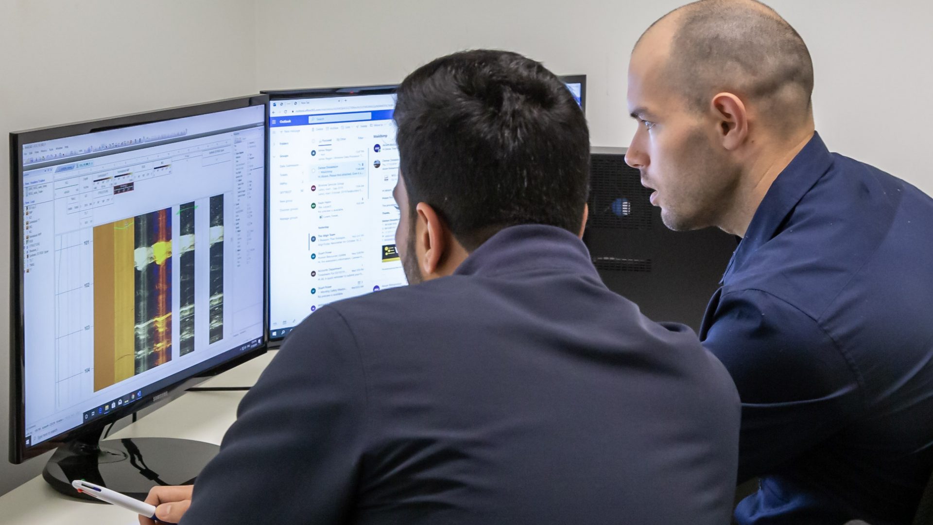
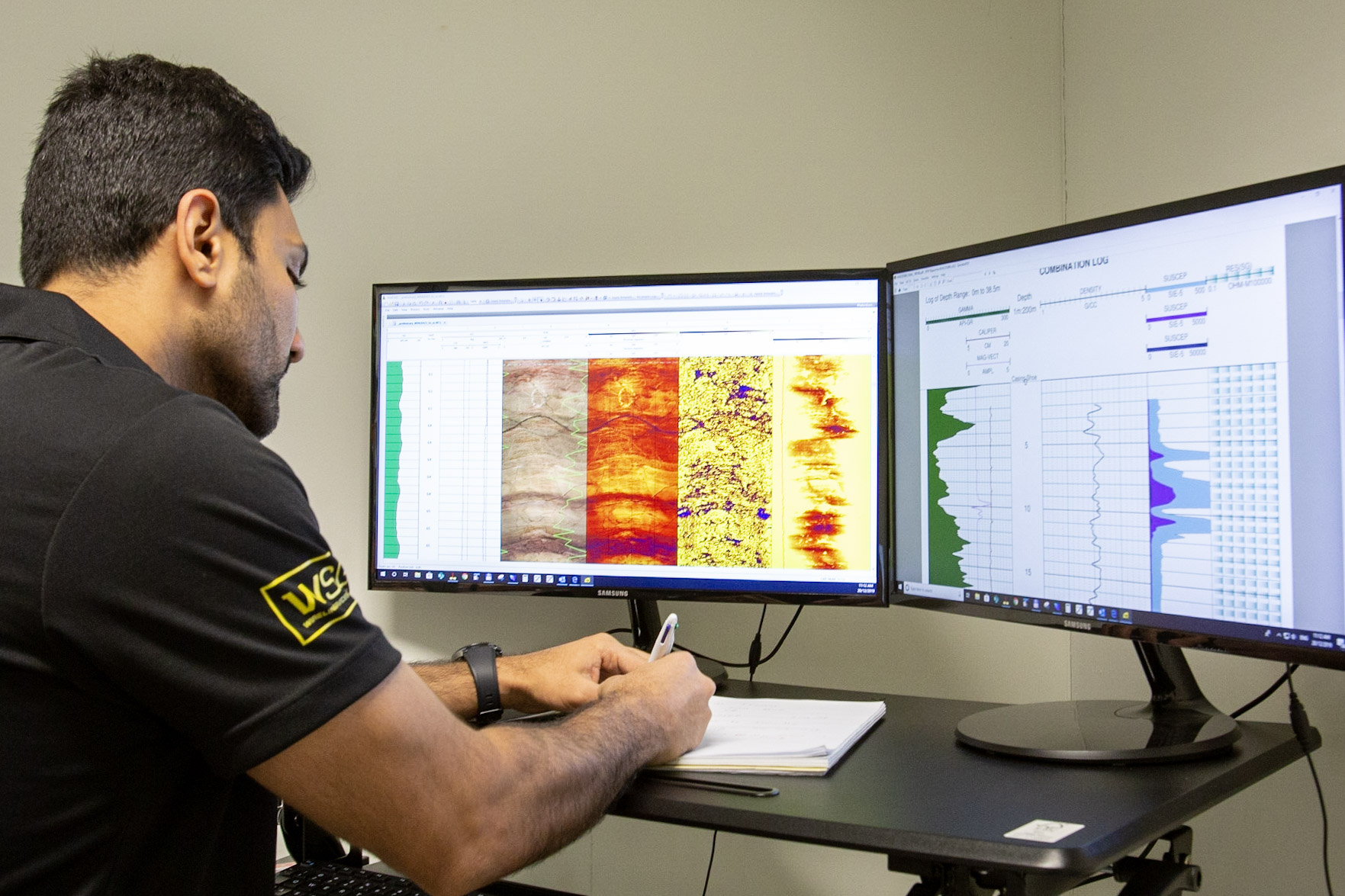
No matter how your data is acquired, our data processing centre delivers deeper insights and a clearer picture of your subsurface environment.
Unlock the full value of every dataset. Whether you require standard, specialised or fully customised analysis, our in-house teams of geologists and geophysicists ensure you receive precise, high-quality, and actionable results.
Collaborative Expertise
Our data science teams in Australia and Canada oversee the quality and delivery of field data, ensuring accuracy from acquisition through to final interpretation. They manage post-acquisition processing, product generation, and continuous support, delivering reliable data solutions that drive confident decision-making.